


In September 2015 QinetiQ and Rockwell Collins UK demonstrated, for the first time, the use of both military GPS and the new European Galileo Public Regulated Service to deliver resilient Positioning, Navigation and Timing. In May 2016, QinetiQ, Ordnance Survey and NSL delivered authenticated PNT using Galileo’s PRS signal via the Cloud, paving the way for its wider application by users including critical national infrastructure, security and the emergency services.
MOD DCB features editor Julie Shennan caught up with Dr Nigel Davies, Head of Secured Navigation at QinetiQ, to track this and more of Galileo’s developments.
Over ninety per cent of military equipment platforms and systems are reliant on space; this was the finding of the 2010 report Defence iQ Military Satellites: UK Space Capability Development.
The report outlined satellite communications, navigation and timing solutions as critical to the Armed Forces’ ability to deliver synchronised operations across the air, land and maritime domains.
While acknowledging the military’s reliance on space for accurate defence intelligence, the same report noted the limitations of using extant close to earth satellites systems, which were becoming increasingly congested and competitive, rendering them subject to interference.
In the past the UK’s Global Navigation Satellite System (GNSS) users depended on US Department of Defense GPS or Russian Global Navigation Sputnik System (GLONASS) signals. To resolve the issue, the UK Government invested in a consortium of UK and European partners as they developed a civil European GNSS called Galileo. Galileo includes both open service signals for civilian use and an encrypted service, called the Public Regulated Service (PRS), for governmental users including the military.
Galileo gave Europe and the UK GNSS independence, as well as a seat at the rapidly expanding GNSS global table.
The programme was designed to be compatible with all global navigation satellite systems and interoperable with GPS and GLONASS. Through this design, Galileo is enhancing the global satellite coverage available – providing a more seamless and accurate experience for multi-constellation users around the world.
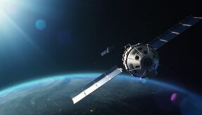
On 21 October 2011 the first two of four Galileo satellites were launched – operational satellites designed to validate the Galileo concept in both space and on Earth. Two more followed on 12 October 2012.

Galileo Satellite_19527A4 – CREDIT ESA
This In-Orbit Validation (IOV) phase was followed by additional Full Operational Capability (FOC) satellite launches. Four pairs of FOC satellites were launched by Soyuz from French Guiana on 22 August 2014, 27 March 2015, 11 September 2015 and 17 December 2015.
QinetiQ received an early contract from the European Space Agency (ESA) to develop Galileo PRS test user receivers to verify the Galileo system. QinetiQ has, since then, been leading the development of next-generation resilient receivers making use of PRS for secure intelligence and Precision Navigation and Timing (PNT).
QinetiQ’s Head of Secured Navigation, Dr Nigel Davies, said: “QinetiQ has a long involvement with Galileo, the new European satellite navigation system service, both on its open service – akin to the ones that we have in our smart phones – and its encrypted Public Regulated Service.”
Galileo operates a Public Regulated Service which authorises users, such as governments and the emergency services, to use PRS encryption for service security in the face of threats such as spoofing and interference.
Dr Davies explained: “Interference can come from sources both intentional and non-intentional; non-intentional interference can occur because commercial satellite navigation receivers have not been integrated well into the rest of the system. Other forms of interference can come from things like radio transmissions.
“Then there are the intentional interferences, such as nuisance attacks from things like personal privacy vehicle tracker jammers as well as more criminal-level attacks by people who want to steal cars with vehicle trackers. The most extreme type is state and military attacks.”
Galileo is one of the tools QinetiQ uses to mitigate signal interference and spoofing threats. QinetiQ’s multi-constellation receivers process multiple satellite navigation constellations including GPS, Galileo and, where appropriate, GLONASS and the new Chinese GNSS service called Bedidou. Further robustness is achieved by exploiting the fact that many modern GNSS signals are transmitted on multiple frequencies.
Dr Davies commented: “In addition to this there are advanced signal processing technologies that can identify and mitigate interference. We also have smart and anti-jam antennas that can be fixed to the front of receivers to identify the direction of interference to steer the satellite and give spatial mitigation.
“We also integrate other sensors into our navigation systems, which work with satellite receivers to tolerate some jamming and interference, but still work through it.”
Signal disruption threats are increasing as the use of satellite navigation continues to increase; a fact reflected in the 2015 Strategic Defence and Security Review (SDSR). The review identified the need for more robust precision navigation and timing (PNT) across the whole defence estate to support a broad range of military capabilities.
As Dr Davies noted: “Resilient satellite navigation capability is one of the most important things on the military agenda.”
The introduction of Galileo has diversified the satellite market by increasing its robustness, security and performance. At the same time the application of new-generation technology and advanced signal processing has allowed suppliers to build more robust, lower-weight solutions with improved power consumption. This is particularly important to users such as the soldier in the field, because it minimises the number of batteries that must be carried, reducing their man-portable receiver’s weight and allowing them to be more agile.

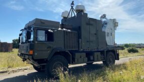
PRS Accessed via Cloud to Power Drone
In May 2016, Galileo’s PRS was delivered via the Cloud for the first time. Ordnance Survey in Southampton successfully demonstrated three different user scenarios, which involved an Unmanned Aerial Vehicle (UAV), a surveyor with a GNSS receiver attached to a mobile phone, and a static reference receiver.
In each scenario, the receiver captured signals from both Galileo’s open-access and PRS signals, as well as open GPS signals. The three different users were located around the Ordnance Survey site, simulating routine tasks. Captured by their receivers the signals were sent, via cellular 3G links, into the Cloud to be processed.
Position and time was calculated from the open-access signals by servers at Nottingham Scientific Ltd’s GNSS site. The secure PRS signals were decrypted and authenticated by a QinetiQ site in Malvern that was hosting the cryptographic keys. This confirmed the position and timing reported by the open-access signals.
This QinetiQ-led test demonstrated ways in which defence could use the Cloud to overcome security protocols required when managing the cryptographic keys needed to access the signals.
To further enhance Galileo’s capabilities, QinetiQ has started work on next-generation receivers. In the context of military capability this includes development of highly resilient so-called dual mode receivers which process both the encrypted military GPS signals and the Galileo PRS. In 2015 QinetiQ and Rockwell Collins UK achieved the first demonstration of this technology under a programme called PERMIT which was sponsored by the UK Space Agency and the MOD.
The receivers will be ready when Galileo reaches full operational capability by the end of the decade.
The fully deployed Galileo system will consist of 24 operational satellites plus six in-orbit spares, positioned in three circular Medium Earth Orbit (MEO) planes at 23,222km altitude above the Earth, and at an inclination of the orbital planes of 56 degrees to the equator.
Initial services will be made available by the end of 2016. Then, as the constellation is built up beyond that, new services will be tested and made available, with system completion scheduled for 2020.
While working on Galileo QinetiQ is also developing the next generation of satellite navigation systems.
Dr Davies added: “QinetiQ is supporting the European Space Agency and the European Commission in developing the next generation of satellite navigation systems. Before Galileo is even fully deployed, industry and Europe are thinking about the next generation of increased robustness. QinetiQ has already completed a lot of work developing more robust wave forms for the next generation.”
Looking to the future, Dr Davies predicts that space technologies will continue to become more transferrable between the civil and defence sectors.
He concluded: “A lot of the work in space is about space science – you have to ask how this technology can be applied to solve defence problems and form practical applications.
“I believe satellite technology will continue to devlop and capitalise upon the new constellations and new wave forms to bring assured capabilities to user communities, such as the military.”
For more information, visit: www.qinetiq.com/media/news/releases/Pages/ground-breaking-new-robust-gnss-receiver-from-qinetiq.aspx
If you would like to join our community and read more articles like this, then please click here
Cloud Dr Nigel Davis Drone Galileo MOD DCB PRSA QinetiQ satellite UAV

Post written by: Julie Shennan
Features Editor of MOD DCB Magazine and MOD DSS Yearbook. Content Marketing Executive at BiP Solutions (Defence Online's sister company). Editor and founder of Artsnfaffs Online Magazine.
RELATED ARTICLES
February 13, 2025
Homeland - Scottish rocket launch boost to get Britain back into space race
A landmark Scottish rocket launch is set to solidify the UK as a European leader in the space sector, following
January 16, 2025
Land - Radio Wave drone killer sucessfully tested
Game-changing Radio Frequency Directed Energy Weapon (RFDEW) neutralises drone swarms for just 10p per shot, supporting over 135 skilled UK